Data Overview
PIT tag data are organized around five types of data collection events which are linked by the unique ID encoded into a PIT tag.
Mark
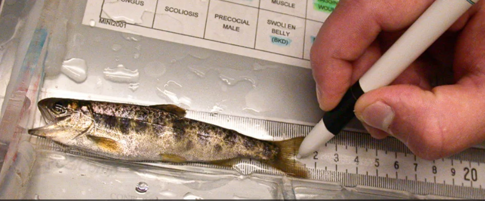
When a tag is first implanted in a captured fish and that fish is released.
Recapture
When a PIT-tagged fish is recaptured, processed, and re-released.
Observation
When a PIT-tagged fish is detected by automated detection equipment at an established interrogation site.
Passive Recapture
When a PIT-tagged fish is not handled, but is instead detected by an ad-hoc antenna or detection equipment that is not part of an established interrogation site.
Recovery
When a PIT-tagged fish is sampled after death or a bare tag that was previously implanted into a fish is recovered after the fish was released.
Mark / Recapture / Recovery (MRR) Data
When fish are captured for tagging, or recaptured after tagging, or recovered after death, those events are collected and reported as MRR (mark/recapture/recovery) data. MRR data records are usually captured while the fish is in hand and include biological and condition information along with information about when, where and who collected the data. The PTAGIS Data Specification provides a complete list of the PTAGIS data fields (both required and optional) that can be collected for each type of event.
MRR data can be collected and submitted using free software developed by PTAGIS called P4. Data collected with another tool can either be imported into P4 for submission or submitted via the PTAGIS API in the P4 file format. The PTAGIS Data Specification provides details about file requirements and formats .
The Event Type field identifies a record as a mark, recapture or recovery data collection event, and is assigned by the researcher during data entry. Other event types can be assigned when records are loaded into the database, such as duplicates, orphans and disowned records. For example, when MRR files are processed for loading into the database, each newly submitted record is checked against records already in the database. If a new record appears to be a duplicate of an existing record, it is loaded into the database with the appropriate duplicate event type (e.g. Duplicate Mark Event), and the data contributor is notified. The PTAGIS Data Specification provides definitions of each event type.
Interrogation Data
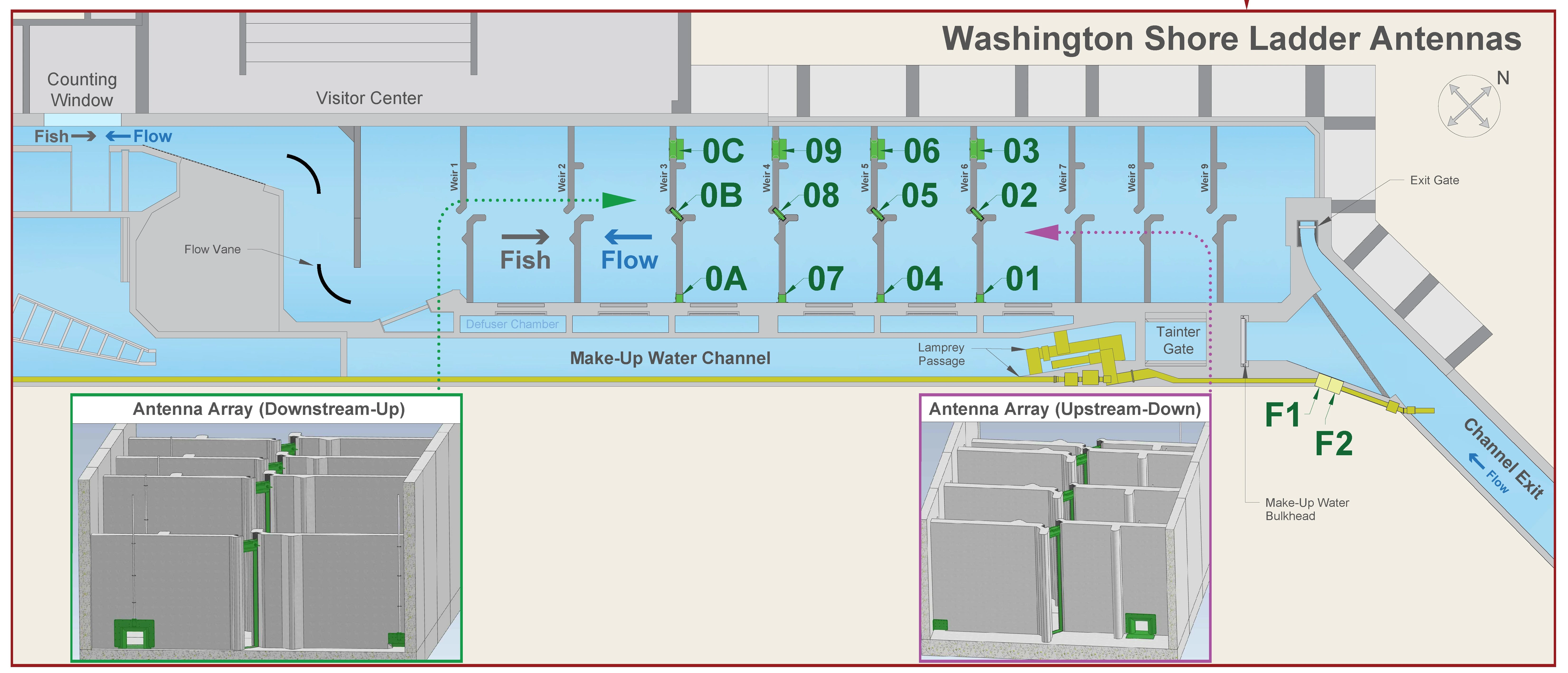
When a PIT-tagged fish passes by or through an interrogation site, which consists of specialized RFID equipment that can detect PIT tags, an observation event occurs. An observation event consists of the unique PIT tag code, the location at which it was detected and the date and time in Pacific Standard Time. In addition to observation records, diagnostic data from detection equipment is also recorded and used to monitor the performance of the automated system.
The location of the observation is recorded as a Site Code, which represents a registered interrogation site. Metadata for each site is maintained, that includes the coordinates, antenna arrangement, type of equipment, operational status, contact information, and diagrams and pictures. The Antenna ID represents the specific antenna at that site on which the tag was detected. The diagram below shows how the antennas (shown in green) are arranged in one of the fish ladders at Bonneville Dam.
PTAGIS operates 30 interrogation sites, primarily at facilities located in mainstem Columbia and Snake River hydropower dams. Several hundred more interrogation sites are operated by other organizations throughout the Columbia Basin, primarily at remote tributary locations. Before using interrogation data from any particular site, it is important to understand the antenna configuration and operations history of that site, which can be found on the Interrogation Sites page. Interrogation site locations can be viewed on a web map or downloaded as a geodatabase on the GIS data page.
Contributing Data
PTAGIS welcomes the addition of PIT tag data from new contributors working in the Columbia Basin. MRR data are contributed to PTAGIS under a specific MRR Project. Each MRR Project has a coordinator who is ultimately responsible for the MRR data submitted under that project. Interrogation data are contributed for a specific registered interrogation site. Each site has a data steward who is ultimately responsible for the data contributed from that site. The coordinator’s and data steward’s contact information are publicly available so that data users can contact them as recommended in the PTAGIS Data Policy. If you are interested in submitting data to PTAGIS, please review the Data Policy and see the Contributing Data to PTAGIS section in the PTAGIS Data Specification for more information on how to get started.
Using Data
All data stored in PTAGIS are freely available to anyone via this website. Before using the data, you should read and understand the Data Overview section of PTAGIS Data Specification and the Data Policy.
Reports under the Data menu are available without needing an account to login. These reports are limited in scope and customization options, but provide a quick way to look up the event history for a PIT tag (Complete Tag History), see the observations at a site (Observations or Adult Ladders), or to view summaries of all records in PTAGIS (Record Summaries).
The Advanced Reporting system allows registered users to create and save custom queries, export the results to a variety of formats and to schedule those queries to run automatically and email the results or export them to the PTAGIS FTP site for retrieval. See the Query section for more information about retrieving data from PTAGIS.